Monday, January 9, 2023

Dive Bars & Drinking Saloons of Central Jersey

Taverns where drinking takes precedence over food, if there even is any. Some are nice places with clean bathrooms while others have questionable sanitation. Quite a few are known for their food on a limited menu with tiny kitchens. All of them function as working class watering holes during the day while some have a younger crowd at night.

Liquor store bars make up a good deal of the list as they seem to have become the workhorse of the modern dive bar. There are quite a few I know only by reputation and bar stories. Let me know what I've missed or if you have some salient detail to add to yer favorite liquor fountain. 

Regardless, please don't write and tell me that your establishment is not a dive bar. If you let me drink there then...


I'd never belong to any club that would have me for a member.”      ~ Groucho Marx

Thursday, April 13, 2017

Waackaack Creek


Waackaack Creek :  The watershed region of Keansburg


Waackaack (pronounced "Way-kay-ack") which means Land of Plenty in Leni-Lenape, is the original name of the area around Keansburg.  Waackaack is also the name of the creek that runs through it.  The creek starts at the Raritan Bay where it separates into two sections, Waackaack and Thorne.  Both sections weave through the wetlands past Highway 36.  Waackaack threads through Alloco Park in Holmdel and into Middletown, where it terminates at Dorsett Park.

The Leni-Lenape derived much of their diet from food, sourced in the creek.  Although, today most folks see it as a source of recreation rather than sustenance.  Boaters see the creek as a quick access to the bay and anglers take advantage of the cove areas for fish and crab.  However, the creek serves as a conduit for tidal water and storm surge, directing these waters into wetlands where it can be safely absorbed.

While the Waackaack Creek and its surrounding wetlands appear to be nothing more than a swamp to many people, the entire watershed region serves a valuable function.  On a basic level, it helps contain storm water and tidal surge, to prevent coastal flooding.  Wetlands provide water storage and act like a natural sponge.

Further, the area serves as a habitat for diverse fish and wild life.  While this may not seem as great a function as flood control consider this, it also improves the quality of the ground water.  A diverse ecosystem of plants and animals filters sediment, nutrients and pollutants from the water.


Currently, there is work being done on Church Street Bridge, over the creek, which almost collapsed in 2015.  The bridge was 71 years old and constructed of timber, it was last reconditioned in 1966.  The county engineers declared it "structurally deficient" in 2012 with a rating of 33.6 out of 100.  The wood rotted over time and it wasn't until a number of drivers noticed the pot holes were larger & deeper than usual that another inspection of the bridge was made.

The Hazlet road department immediately closed the bridge upon closer examination.  The construction of a new bridge is estimated to take eight months.  However, remember the Bray Avenue Bridge in East Keansburg was out for 42 months, following construction delays and financing problems with the federal government.

Original Bridge on  Stone Road 1912 (Church Street / 10th Ave)
Church Street, aka 10th Ave., aka Stone Road
Church Street Bridge Out
Church Street Bridge repair over Waackaack Creek

The pollution of the creek through fertilizer run off and the dumping of simple organic debris has become a serious matter.  Dumping organic matter like leaves and grass into the creek and wetlands creates problems in a number of ways.   The material becomes soil as it breaks down, this process removes dissolved oxygen that fish need and promotes algae bloom in lakes and ponds down stream. The soil itself promotes greater flooding as it inhibits the wetlands from absorbing storm water and tidal surge.

August of 2016 saw an enormous kill off of fish in the Keansburg Harbor, Thorne and Waackaack Creeks.  The fish died due to low levels of dissolved oxygen in the water which developed from high temperatures and increased organic material.  Dumping leaves and organic debris into the creek increases this affect.  More than 5000 pounds (2.5 tons) of peanut bunker (menhaden) died and had to be disposed of, each weighing only a few ounces.  The cost of disposal was several thousands of dollars.

Thousands of Dead Peanut Bunker

Dead Peanut Bunker (Menhaden)

There are a number of organizations in the area that promote conservation of wetlands and the tidal creeks that comprise the watershed region.  The Bayshore Regional Watershed Council is a non-profit group that promotes the responsible use and preservation of the land while protecting it from poorly planned development and pollution.  NY/NJ Baykeeper are another group that strive to accomplish similar goals.

How can Keansburg promote interest in maintaining the creek and its ecological concerns?  We can create events and activities that promote use and responsible management of the water shed region. Recently, the town added a retaining wall on the creek near Laurel Avenue, protecting the area from further erosion.  The added sidewalk and railing is now utilized by local fisherman and crabbing.

One simple idea to promote interest is to create a launch area for small craft like canoes and kayaks. A kayak & canoe launch would promote public access to the creek.  Public interest would generate tourism through paddling, fishing and bird watching.  Further, ecological concerns would be monitored more closely by those users. The creeks relative isolation makes it easier for polluters. People who use parks and lands have a vested interest in maintaining them.

A proposed Waackaack Creek canoe & kayak launch:  One area to be considered is the tail end of the parking lot in St John's Park (Baseball Field and Skate Park) just off Hwy 36, at the end of in St. John Place.  The area already looks as if it is being prepared, perhaps due to snow plowing in the past Winter?  I imagine the sand is for maintaining the baseball field.  Another possible site is the Church Street Bridge area currently under construction.

St John's Park parking lot


St. John's parking lot, aerial view


12 Ways To Stop Storm Drain Pollution


For additional information see:

Keansburg Parks & Recreation

Why Waackaack Creek Is Worth Preserving

Why Wetlands Are Important

Restore The Raritan Bay

NY/NJ Baykeeper Organization

Hazlet Keansburg Bridge Unsafe Closed

Organic Matter - Low Dissolved Oxygen

Waackaack Fish Kill

Cleanup Of More Than 1 Million Fish

Why Dumping Yard Waste Into Wetlands Is Illegal

N.J. Public Access Handbook

Wednesday, April 12, 2017

Natco Lake: A brief history and possible redevelopment.

Natco Lake:  A brief history and possible redevelopment.


Natco Lake District concept art


Natco lake is a man made body of water located on the former site of a clay brick mine.  Natco is an acronym of sorts, that stands for the National Fireproofing Company (where did the 'f' go?).  The company which existed through the 1930’s mined the area for clay mud that was rich in alumina and silica.  This mud is the integral ingredient in the creation of fire bricks, used in the creation of heat resistant insulation, ceramics and ovens.  

While mining, earth moving equipment uncovered an underground spring which flooded the pit area.  Pumps were brought in to clear the area but they failed to stem the flow of water.  Eventually, someone got the idea to drain the lake by digging a ditch and connecting to Thorne’s Creek.  Another ditch was dug to connect the Northern and Southern lake halves. 

Unfortunately, they failed to understand the tide table.  While the lake did seem to empty initially, this proved to be a mistake as the tidal creek swelled later in the day and filled the mine with sea water from the brackish creek.  You can still see the remains of a construction crane in the rear portion of the lake, at low tide.  The cost of dewatering the mine was weighed against the declining value of clay and the life cycle of the mine.  Natco abandoned the facility and sold off much of the surrounding property.


The lake has a northern and southern section.  The North is located in Union Beach and West Keansburg while the South is on the other side of Highway 36 in Hazlet.  The Northern section is best accessed via the Henry Hudson Bike Trail that comprises the old Central Jersey Rail Line.  There is no parking allowed on Rose Lane or the Highway 36 and IFF is known to tow those who park in their lot.

The Southern section (Natco Park) is a Green Acres bird sanctuary established in 1978 with public access parking behind the Lakeside Manor Banquet Hall.  There are several trails throughout the area that comprise the lake and portions of Thorne's Creek.   A pair of bald eagles along with several other species of birds make the lake area their home.

Natco Park Preserve, southern section

Although, it is not listed as a Superfund site, the area is rumored to be polluted from the run off of a local chemical plant, allegedly.  I remember as a child, a few friends telling me that they played in the mud by the bank and later had a strange rash on their arms and hands.  Hopefully, time has dissipated the reactive properties of the water here.  While both sections feature an array of bird life, local anglers generally balk at the fish available in Natco.  Although, the abundance of bird life indicates that there must be bait fish at the very least.


Natco Lake Island

While the Southern section is a nature preserve, the Northern section has been left largely untouched other than homeless encampments.  One industrious person even set up camp on the small island in the center of the lake for a few seasons.  I wonder how he survived the Winter out there?  There have been several attempts to develop this area for residential and recreational use.  

One such plan calls for greater public access to the lake for recreation and dredging a new canal, connecting the lake through Thorne's Creek to the Raritan Bay.  The plan was developed by Sasaki Associates, as part of a federal competition to protect flood prone areas from hurricane damage and storm surge.  

The idea is to create a diverse habitat for different species of wildlife while developing tidal creek areas for storm surge.  Sasaki’s plan hopes to integrate ecological concerns with ideas to promote tourism and the local economy by “...making room for future wetlands (which) could offer not only relief for flooding, but also new ecological attractions that can support the local economy. “


Sasaki Associates, Ecological Engagement Concept Art


Sasaki Associates, Natco Lake Coastal Park Concept Art

Natco Lake at low tide


Sasaki Field Guide


Natco Park Trails
Natco Lake Map


For additional information, see also:


Saturday, May 21, 2016

Major Storms of the Jersey Shore

Major Storms of the Jersey Shore:  The history of the Jersey shore is punctuated by devastating storms followed by periods of growth & renovation in their aftermath.  Keansburg has suffered through more than a few major storms and hurricanes in its time.  


In many ways the development of the town was altered by storms as much as urban renewal, jet travel and the U.S. highway system.  The advent of commercial air travel and the consolidation of interstate highways allowed urban dwellers to travel farther than they had before.  This nationwide grid often by-passed local towns like Keansburg.  


Urban Renewal (The Housing Act of 1954) brought large tracts of public housing which some believe contributed to a decline in the town's reputation. Public housing deflated property values as several seasonal hotels became permanent residence for families on welfare assistance.


However, it was major storms like Hurricane Donna in 1960, that signaled an end to the town's heyday as a premier holiday resort.  Poor economic conditions made rebuilding less desirable to developers.


The town has made considerable improvements to its infrastructure and development since the early oughts.  However, the affects of global warming and climate change will continue to contribute to a greater frequency and severity of storms along the Eastern shoreline.  Below are just a few of the major weather events of the past century.


The Great Atlantic Hurricane of 1944:
 An intense category 2 storm dropping more than 10 inches of rain in 24hrs on the Raritan Bay area.  This storm caused significant damage to the boardwalk and low lying areas of Keansburg.  390 lives were lost in the hurricane but only 46 on land due to planned evacuations.


Hurricane Carol of 1954:  Category 3 hurricane was the costliest storm in the history of the US at the time.  The high  winds and high waves cause significant damage to the New Jersey coastline.  Only two lives were lost in New Jersey, due to downed power lines.  68 lives were lost to the storm throughout the US.


Hurricane Donna of 1960:  The only hurricane to affect every state on the East coast with hurricane force winds.  The storm briefly reached Category 5 while crossing the Atlantic Ocean.  This storm signalled an end to the town's heyday as a premiere resort as the dock which was extensively damaged was not rebuilt.  The ferry service operated from other ports for a few more years but was effectively abandoned in favor of the Blue Line Bus service.  The Blue Line eventually became Academy Bus that still operates today.
(See Keansburg Steamboat Company)


Hurricane Irene of 2011:  The Seventh costliest hurricane in U.S. history struck in late August causing 15.6 billion dollars in damage.  The storm killed seven people in New Jersey and 1 billion dollars in damage.  Flooding and wind damage caused power outages throughout  the region for several days.


Hurricane Sandy of 2012:  The superstorm was the second costliest in U.S. history and its effects are still felt years later.  The storm affected 24 states but was most severely felt in New York and New Jersey.  The storm caused 75 billion dollars in damage and took 233 lives.  Many homes were lost to flooding and storm damage.  Most of the shore area was without electricity for several weeks.  The combination of high tides, a full moon, global warming and high pressure system over Canada exacerbated the storms affect.  


Beach Erosion on the Raritan Bay


See Also:  List of New Jersey Hurricanes;  Living With The Jersey Shore

Sunday, June 22, 2014

Tall Houses of Keansburg & Union Beach

Tall Houses of Keansburg & Union Beach:

A great many homes have been raised above the FEMA flood plain after Hurricane Sandy to prevent future flood damage.  Many of these houses were once Summer bungalows but are now being raised well above their original foundations.  Some houses have been simply demolished to make way for entirely new constructed homes.


These tall houses vary in elevated height from two to more than twenty feet high.  Many insurance carriers provide incentives for homeowners to raise their homes to the maximum allowable height as a hedge against future flooding.  However, some residents have had difficulty collecting from their insurance companies regarding these elevation expenses.


While raising houses above the floodplain is a popular solution, a number of homes have collapsed during the process due to structural weakness and improper lifting.  


Home Slides Off Foundation While Being Raised

Houses are classified according to flood zones.  Houses in Velocity or V zones (purple) are directly impacted by tidal waters and must have wood or concrete pilings & breakaway walls.  Houses in A zones (green & blue), while still required to elevate, can use standard block wall foundations.  X areas (gray & yellow) are exempt from any change in elevation.


There is a considerable cost difference between elevating a house in a V zone and and A zone according to building codes.  Any house classified in a V zone is subject to these stricter building requirements and their associated construction costs.


The map below shows FEMA flood zones after 2012 in Keansburg and Union Beach. 


Click here to determine your flood zone:  Base Flood Elevation Tool


When a house is raised, the public utilities (gas, electric, water and sewer) are disconnected and isolated from the structure.  The building is checked for structural damage, before temporary beams are put in place, to aid in lifting.  


Large hydraulic, house jacks are used to slowly elevate the structure.  Railroad ties are often utilized in a cross hatched square pattern to secure the house temporarily.  


Once raised to the proper point, permanent supports are added, depending upon the flood zone classification.  Concrete or wood pilings are more expensive than a simple block foundation to install.  


Keansburg Tall Houses:


One of the first houses to be raised after the storm, the Andalora family used personal savings while waiting on their insurance company.  The house on the corner of Evergreen Place and Forest Avenue, is raised to a total height of 32 feet, at nearly 16 feet above sea level.  This is an area historically prone to surface water and storm flooding.  Keansburg Family Pays For Raising Home


A home raised on Beacon Blvd near Shore Blvd.  The front deck and fencing obscure the elevation of more than 7 feet.  A great many homes are raised to the maximum but this owner chose a minimum height.


A home being raised on Beaconlight and Shore Boulevard, near completion in a V zone with concrete pilings.


A large multi family house on the corner of Bayview and Center Ave.  This newly constructed house  features extensive stairs & decking, found on many raised homes.  The original structure was raised but partially redesigned with a new roof and side entrances.  The same yellow bungalow can be seen in the background of both photos.


A modest home on the corner of Campview and Center Avenue on concrete pilings, nears completion after more than a year.


This home is located off Seeley Ave in the Waackaack Creek section of town.  The structure appears to have no floor because it was originally set upon the concrete slab, set below it.  Exposed beams are painted white to prevent mold and rot.  The finished product is almost unrecognizable below with a porch in front & back and a small garage.


Two homes being raised on the corner of East Shore and Fox Avenue across from one another.  One is nearly complete and the other still adding to the block foundation.


A new elevated home on Park Avenue.


A new home on the dead end of Woodside Avenue.


A raised house on Twilight Avenue near Grove Place.


A small raised home on Grove Place.  A street which is known to flood on even light, rainy days.


One of the first homes to be lifted after Hurricane Irene in 2011, on Brookside avenue.


Two new elevated homes on the dead end of Raritan Avenue.


A small home is raised on Center Avenue near Raritan.


An elevated home on Birchwood Avenue.


Another raised home on Brookside Avenue.


An elevated home at 88 Saint Mark's Avenue.


A new raised home on Forest Avenue near Lawrence Avenue.


 A modest seasonal bungalow "Summer Salt" elevated on Seaside Place.


Several raised houses on Bayview Avenue near the beach.


Several houses in Beaconlight section of town have been raised above the flood plain.  The elevated house at 21 Beaconlight was built from scratch after suffering from storm damage.


Two raised houses on the corner of Beaconlight and Birchwood Avenue, across from one another.


There are a number of elevated new homes on Lawrence Avenue, near Shore Boulevard.


An elevated home on Lawrence Avenue near Twilight Avenue.


An elevated foundation awaiting the construction of a new home on an existing site on the corner of Lawrence and Woodland Avenue.  Often, it is cheaper and easier to build an entirely new home than to lift and renovate an existing structure.  Many families are faced with this emotional and financial decision.


Three newly constructed houses in a row on Woodland Avenue are elevated above the flood plain.


This existing structure was lifted above flood plain.


The existing structure was demolished and a new two family house constructed in its place at #62 Woodland Avenue.


Two additional raised homes on Woodland Avenue near Beaconlight Avenue.


Multi family new home construction on the beach at Ocean Boulevard.  Owner was unable to save existing building after damage.


Another home being demolished on Shore Boulevard due to storm damage.


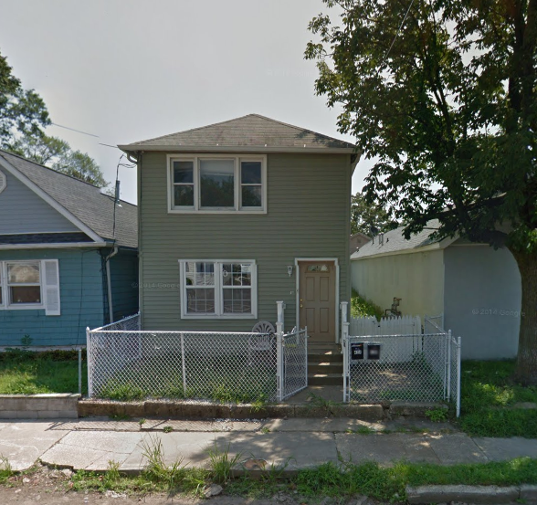
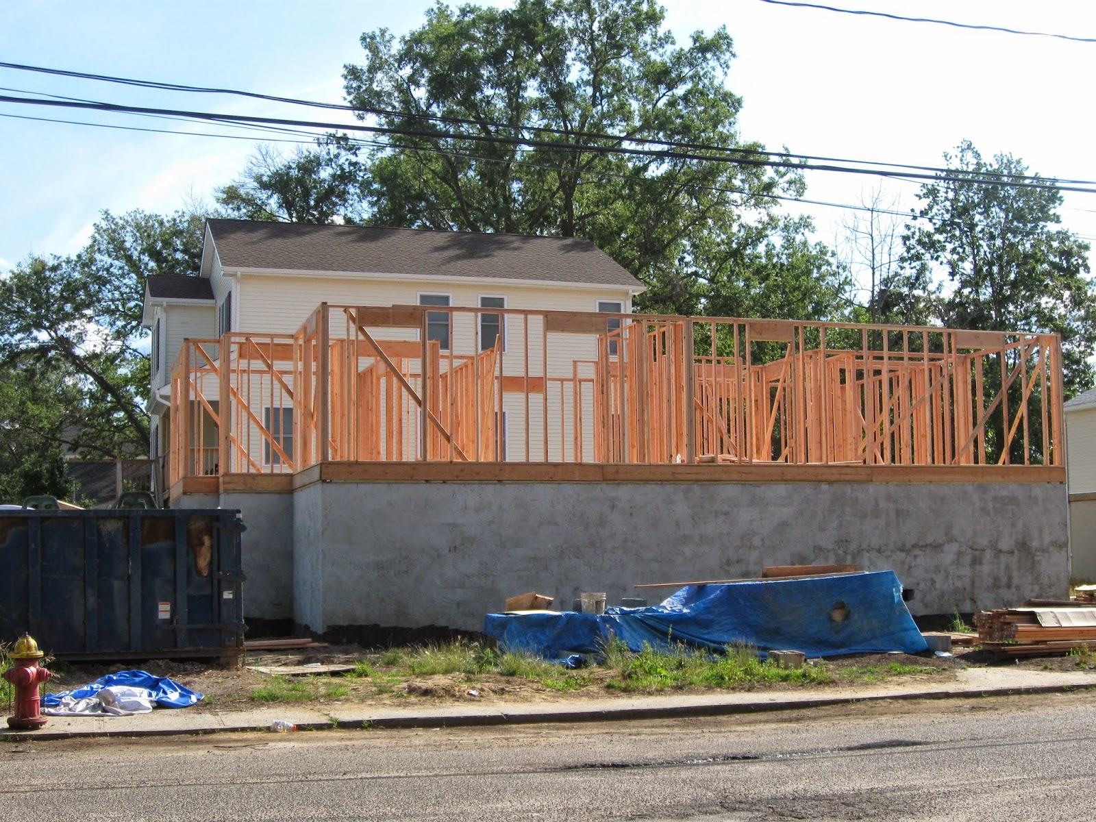
New home construction on an existing site 71 & 73 Bayview Avenue.  Both are elevated platforms on a narrow footprint lot.  Vinyl fence and an adjacent bungalow can be seen in both photos.


Elevated house at 17 Oceanview.


An older bungalow awaiting vinyl siding after being lifted on Pineview Avenue.


Another small home being raised on Pineview Avenue.


An existing home is raised on Campview Place, at the dead end of either street.


An interesting new design for a raised home on the corner of Campview Place & Ave.  This house features concrete pilings and a small enclosed garage.  Apparently, the house is available for rent.  The original structure is obscured by a tree below.


A raised house at 22 Belleview Avenue.


A home being raised on Neptune Place.


A home being raised at 129 Seeley Avenue.


A home being raised at the dead end of Saint James Place.  The original white block pilings can be seen in the photo for comparison.


Union Beach Tall Houses:


While Keansburg suffered a great deal of flooding in Hurricane Sandy, the structural damage to homes in Union Beach was far greater, in many instances.


A new home was to be constructed on the site of this famous photo, which was featured on the cover of Newsweek.  This historic home, more than 100 years old was originally a sea captain's house.  Hurricane force winds sheared the house in half which teetered for many weeks before being demolished.


Currently, an empty lot awaiting development.  The original hurricane fence can still be seen in both photos.


There are several new homes on  Front Street.


One of the first homes to be raised after the storm near the corner of Dock Street and Second Ave.  This house used a combination of a block wall foundation in the back and concrete pilings in the front to support the enclosed porch area.


The Harris Avenue section of Union Beach was particularly devastated by the Hurricane Sandy.  However, this street is now a showplace of raised and renovated homes.  Nearly every home on this street received some sort of storm damage and has been subsequently, repaired extensively.


A modern looking,  elevated home on wood pilings at the corner of Willow Street and Harris Avenue.


A new home with masonry and stucco accents on Harris Avenue.  The original brick staircase can be seen in the photo below for a height comparison.


A new home being constructed on Harris Avenue.


A new home built on wood pilings on the corner of Harris and Asbury Avenue.


A home that has been lifted at 1021 Harris Avenue.


 Two elevated homes on Patterson Avenue.


A frustrated homeowner on Patterson Avenue with a message for their insurance company.  The sign on the garage door reads "Give me my money! I want to fix my house!"


An elevated home on Isabella Avenue.


Two raised houses on Jersey Avenue.


A raised home at the dead end of Brook Avenue.


A reminder of the looting policy in Union Beach after Hurricane Sandy on Brook Avenue.


A number of raised homes on Brook Avenue.


A raised house on the corner of Bayview & Union Avenue.


Two raised houses on wood pilings Union Avenue, in between Brook and Prospect avenue.


A small house that has been raised on the corner of Bayview & Union Avenue.


A raised home on the corner of Union and Brook Avenue.


There are a number of raised homes in the Dock Street section of Union Beach.


Two newly constructed homes elevated on a narrow footprint.


Another new elevated home, built on an existing site on Dock Street.


A raised home on Fourth Street.